The sources of the Alpe della Luna: Marecchia, Foglia and Metauro
Primary tabs
The sources of the Alpe della Luna: Marecchia, Foglia and Metauro
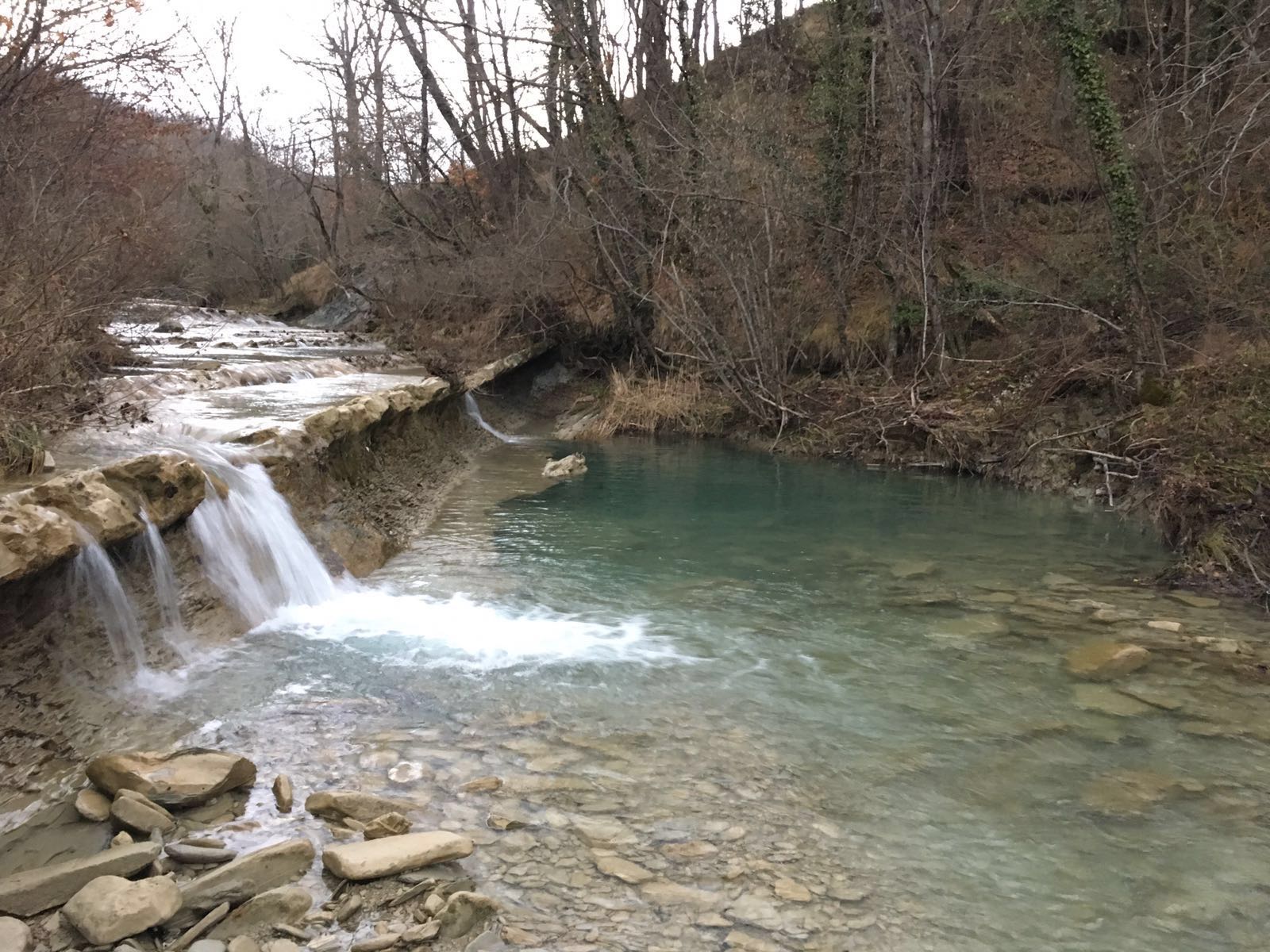
The other element that characterizes the territory of Alpe della Luna and Badia Tedalda is the presence of water, in all its forms: springs, streams, ditches, waterfalls.
From the ridge, covered with woods with centuries-old trees like Pratieghi with the presence of the taxus (Taxus baccata), an evergreen plant that reaches over 2 thousand years, the Marecchia River (Monte Zucca 1263 masl), Il Metauro with the its main course of the torrent Auro (Monte Maggiore 1,384 mslm) and the Leaf, ancient Isauro, (Monte Sovara 1003 mslm). A triangle of held that embraces Tuscany, Romagna and Marche and that has united in a mix of influences, culture and history even before the Etruscan, Umbrian and Roman peoples.
The Marecchia, the ancient "Ariminus" that gave or received the name from Rimini, flows, after a distance of about 80 km, in the Adriatic, in two branches, one of which is the Rimini port-channel. The banks of the river that lap the Montefeltro, are characterized by fortresses, castles, churches, museums with evidence of rural culture, and the Franciscan tradition. These lands find their immortality in the Renaissance landscapes of Piero della Francesca and Leonardo da Vinci up to the "world" of Tonino Guerra. The river bed is broad and pebbly and takes on a torrential character with the geological feature of having a considerable flow of water under the substrate of its sliding bed with some foci that come out far from the coast, and form pools of fresh water. Absolutely do not miss the waterfall of the tributary Presalino.
Il Foglia, cited as Isaurus by the Latin poet Lucano (39-65 AD), may have also given the name to the city of Pesaro (latin Pisaurum), located at its mouth. Formerly the Foglia marked the northern boundary of the territory occupied by the Picenes and its path cuts orthogonally the tectonic structures, with a sharp deviation at the inner flank of the basin of Montecalvo in Foglia.
The Metauro, with its 121 km is the main river of the Marche region for length. Its name derives from the simple merger by linking the names of the two main branches that originate it: the torrents Auro and the torrent Meta. Another ditch, called Meta, descends from the slopes of the Poggio della Regina to Montelabreve, and flows into the Euro at the height of the ancient crested Mill of Gorgo Scura.
Among the tributaries is the river Candigliano, known for the famous stretch of the Gola del Furlo. In the territory of Badia Tedalda, we point out the Fosso delle Cannucce, characterized by small waterfalls, natural pools and sulphurous springs, which rises up to Colle Quarantelle (1022 m) with a path through woods of uncontaminated beauty, rich in vegetation and spontaneous flowers among which we find varieties of wild orchids. The Metaurus river is known to historians for the terrible and bloody battle of 207 BC, among the Roman consuls Marco Livio Salinatore and Gaius Claudius Nero. To visit the springs of the three rivers there are numerous trekking routes for which it is advised to ask for information at the Offices of Proloco di Badia Tedalda.

52032 Badia tebalda (AR)